Join us in creating a comprehensive understanding of the Maui wildfires to help make Maui safer.
Please help make Maui and other islands safer by contributing images (photos and videos) and written information to help form a scientific understanding of fire spread in the wildland and urban areas and relevant evacuation procedures during fires.

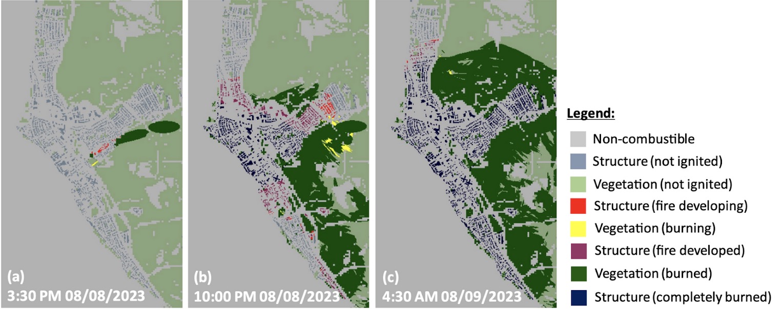
Amid the aftermath of the devastating Maui fires, scientific experts in modeling mainland fires (Camp, Tubbs, Marshall, etc.) and mathematicians developing models for evacuations have joined teams lead by University of Hawaiʻi researchers living on Maui to develop a comprehensive understanding of the Maui wildfires to help make Maui safer. The image above shows initial computer modeling of the fire propagation through Lahaina on August 8th and 9th by teams from the Univ. at Buffalo, Univ. of Nevada Reno, and NCAR. We need information to refine and validate modeling. We are asking the Maui community to contribute by sharing photos, videos, and observations with an initial focus on the Lahaina fires on August 8th and 9th. We need information on fire propagation, wind direction/strength, flying embers, as well as evidence of roads blocked by trees or other hazards that impacted evacuation. Wind speed for example, can be estimated using the guide here. Location of fire can be inferred from metadata as available or provided location.
By contributing to this research effort, you will help us build an understanding of how wildfires spread within communities, interact with urban structures, and identify evacuation issues. University of Hawaiʻi Maui College (UHMC) students are playing an important role in this effort. We are seeking help from all of the Maui community to gather data to help make Maui safer from future fires: see instructions below for how you can help. Collected information will not be shared beyond the research team members without your permission.
Help us make a difference. Upload your photos, videos, and comments below.
Social media: @mauifireresearch
